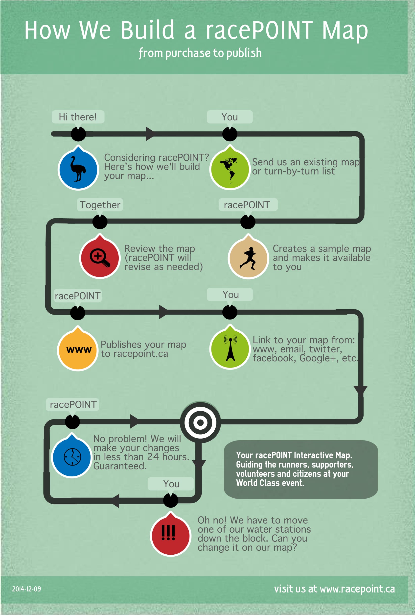
You want to create a world-class race event, but there are many obstacles in your way. Keeping runners, citizens and stakeholders informed – with detailed information – is one of your largest. RacePoint creates custom, interactive maps to solve this problem, make everyone’s lives easier, and ensure your event is a success.
Our maps are built to help inform citizens, spectators, race attendees and your staff of vital information about your race. It’s convenient for everyone.
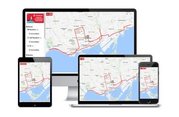
Designed to work seamlessly on desktops, tablets and phones, our maps are easy-to-use for your staff, race attendees, spectators and the public – no matter where they are.
We carefully create a personalized map that routes your race from start to finish. Have unique details to add or need changes within 24 hours? No problem.
Race attendees can prepare for the race by observing route elevations and water stations, medical stations, toilets, and more along their race route.
Racepoint maps are interactive, allowing users to see parking, road closures, water stations, medical stations, toilets and more – making your race event convenient for everyone.
Differentiate your race from the rest with a stunning, interactive map and link to your advertising partners using custom map markers.
Craig created RacePoint to help his own work in organizing the Ottawa Race Weekend. In the process, multiple events became interested in the tool he had created. Today, Craig is continually growing RacePoint and adding features to help race organizers put on world class events across Canada and the USA.
We have a mix of features that meet the needs of your participants, citizens and especially you the organizer.
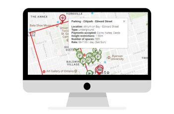
Indicate the location of parking, water stations, information kioks and more. Fill each marker with detailed information.
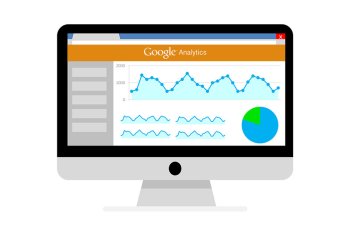
How many people did your race serve? RacePOINT provides you with useful metrics at the conclusion of your event.
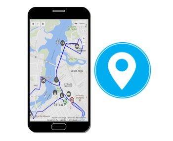
Great for out of town participants or spectators - plot your current location on the map via your phone's GPS.
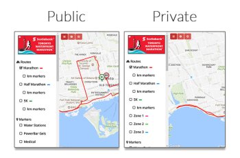
One map view for your participants – and one for your staff. Display additional routes and markers to help meet your organizational needs.
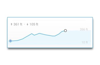
Let your participants know if their path is heading up or down! We'll give you detailed elevation information for each of your routes.

Help your participants easily spread the word about your information-filled beautifully-responsive RacePoint map.
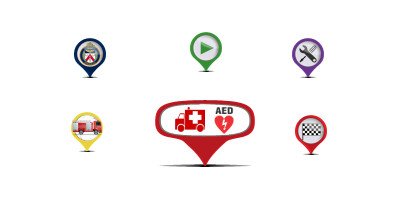
Add custom images onto location markers. Great for showing sponsors on your map.
Make sure everyone attending your race is kept in the loop with multiple languages for your event map.
From small fun runs to national marathons, Racepoint is continuously helping dozens of clients make their races a success with interactive, beautifully-responsive maps. Take a look.
Our newest and first US race - way down in Fort Worth, Texas. Check out their interactive Google map.
The Northwest Arkansas Hogeye tradition continues. . . It's a PRETTY PIG DEAL! Check out their interactive Google map.

The Greater Toronto Spring Marathon is one of Canada's premier running events. See their interactive Google map showing the new start line.
Downhill, sceneic and fast. Prepare for a new PB with their interactive Google map.

Run, walk, jog or stroll down iconic Yonge St. and give the healing power of camp to kids and families impacted by childhood cancer or serious illness. See our interactive Google map.
On your mark, get set, let's give'er. See our interactive Google map.

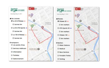
UN ÉVÈNEMENT QUI ÉVOLUE DEPUIS 14 ANS! See our interactive Google map.
Ottawa Race Weekend was the genesis for the development of these maps. Crowds of runners and spectators demand the detailed information provided by a RacePoint map. See the Saturday Map and the Sunday Map RunOttawa has been exceptionally supportive of us.
Supporting the Calgary Marathon Race Weekend. Check out their new interactive Google map.
Supporting the Saskatoon's Marathon Race Weekend. Check out their new interactive Google map.
We have the pleasure of partnering with SunRype TRi KiDS Triathlon Series to provide an interactive map to each of their six races. Click through to see their maps.

Our newest style of interactive Google map has been developed to be responsive to all types of devices.
The Tremblant Resort Association plays host to Subaru IRONMAN 70.3 and 5i50 Mont-Tremblant. See their interactive Google map.
Established in 1999, the Vancouver Half Marathon is one of Canada Running Series’ flagship events in Western Canada. Check out their interactive Google map.
Supporting Inclusion for all Manitobans. Check out their interactive Google map.
Run on a closed section of the TransCanada Highway. Run across two bridges. Run the Poplar Point Trail in Kakabeka Falls Provincial Park. Here is their interactive Google map.
The "friendly" marathon. Approachable, accessible, good-natured, this is the marathon where you will feel right at home. Here is their interactive Google map.
A beer festival with a side of running! Here's their interactive Google map.
Established in 2013, the Under Armour Eastside 10k is a race through the historic east side of Vancouver (Gastown, Chinatown, and East Vancouver). See our interactive Google map.
The goal of the Calgary Police Half Marathon Committee has always been to provide a premier race. Attention to detail and the quality of the performance awards and race give-aways have contributed significantly to the race's popularity. View their interactive Google map here.
One of Canada's Top 5 Boston Qualifiers. View their interactive Google map here.
Five running events located in the heart of Quebec City. View their interactive Google map here.
One of our favourite races on the calendar. TWM's interactive Google map has been developed to be responsive to all types of devices.
Some of the events we've supported in the past.
Come see Muddy the Mudcat at one of Ontario's fastest growing events. See our interactive Google map.
We are proud to be a part of our community and have contributed this map for our friends and neighbours. Check out their interactive Google map.
The Tremblant Resort Association plays host to Subaru IRONMAN Mont-Tremblant. See their interactive Google map.
FLAT, SCENIC, CERTIFIED. The Queen City Marathon is a qualifying race for the Boston Marathon. Here is their interactive Google map.

Our first cycling event supporting the Ottawa Hospital Foundation's premiere cancer fundraiser in Eastern Ontario. Here is their interactive Google map.
Everyone will enjoy scenic views along Lake Okanagan and the surrounding valley and a flat, fast course certified as a Boston Marathon qualifying race. A festive atmosphere the whole family can enjoy. Here is their interactive Google map.
One of the many runs supporting the Terry Fox Foundation interactive Google map.
Our newest style of interactive Google map has been developed to be responsive to all types of devices. We've even added two helpful YouTube videos on how to use this map.
Support Ottawa First Responders with this run outside the Nation's Capital. View their interactive Google map here.
The Huntsville Track Club proudly presents the Rocket City Marathon interactive Google map, one of the premiere races in the south for over 40 years. Our course winds through downtown Huntsville, past historic homes and sites, out to the U.S. Space and Rocket Center, and back to an exciting finish inside the Von Braun Center South Hall.

Every year since 1969, the Ottawa Professional Fire Fighters' Association has been organizing the Help Santa Toy Parade and collecting toys along the parade route for distribution to the less fortunate children in Ottawa-Carleton. Here is their interactive Google map.